Your cart is currently empty
Sorry for the “hi, we were here” version of events. I figured I’d lay out where we went and then maybe break down some of the finer moments later.
Day 4: Arches National Park
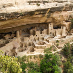
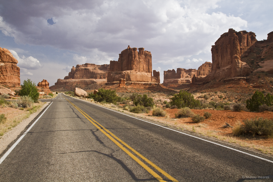
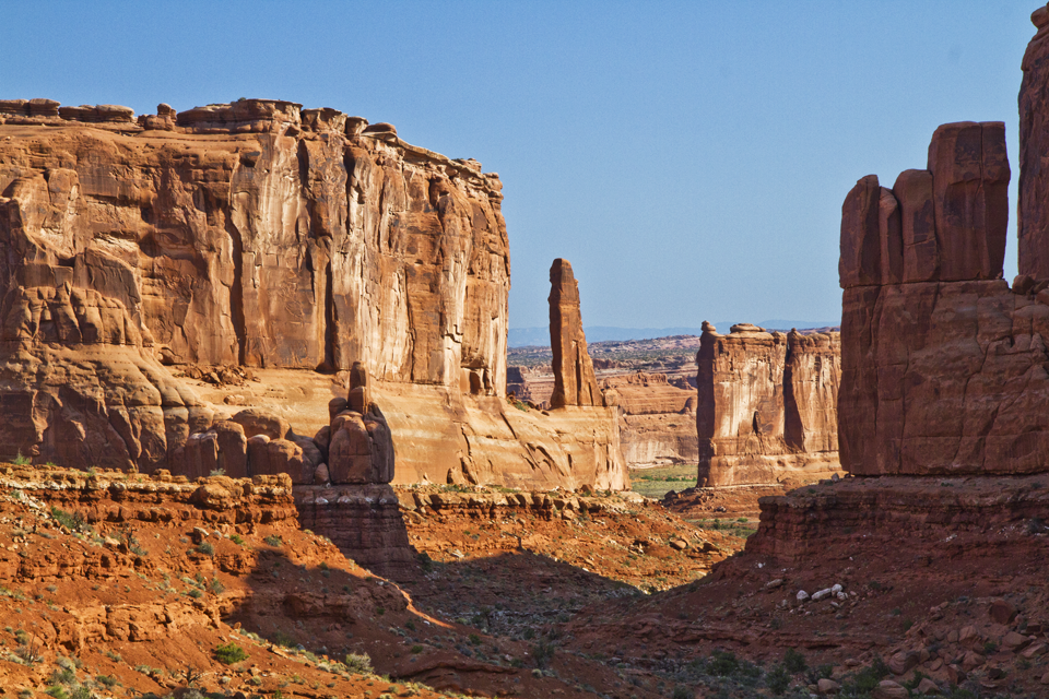
We arrived at Arches National Park in the late afternoon after the 200-something mile drive from Durango, CO to Moab, UT (including the excursion to Mesa Verde National Park).
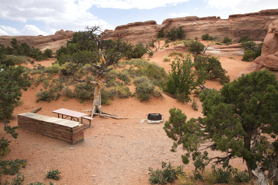
We hadn’t eaten since the lousy hotel breakfast, so we were pretty eager to grill the steaks we had originally intended for the 4th of July. It was a little after 4pm, and we chose to drive into the far side of the park (stopping at a few sites along the way) to one of the two picnic areas.
Travis fired up the grill while I wandered around, taking photos of whatever I found nearby (red rocks, trees, etc). After wandering for 30 minutes or so, the steaks were ready and we enjoyed our lovely meal at the picnic site.
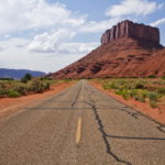
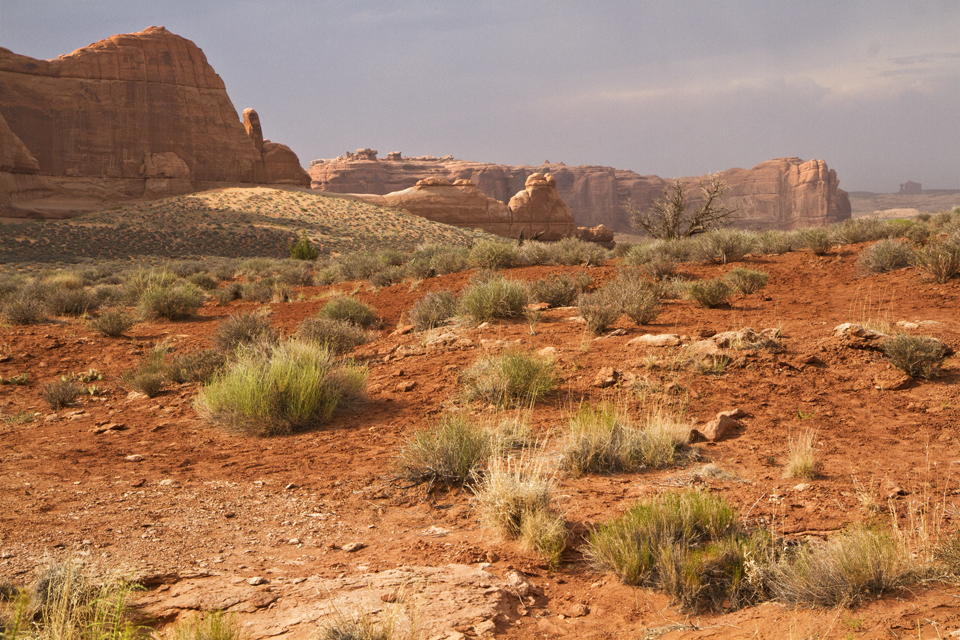
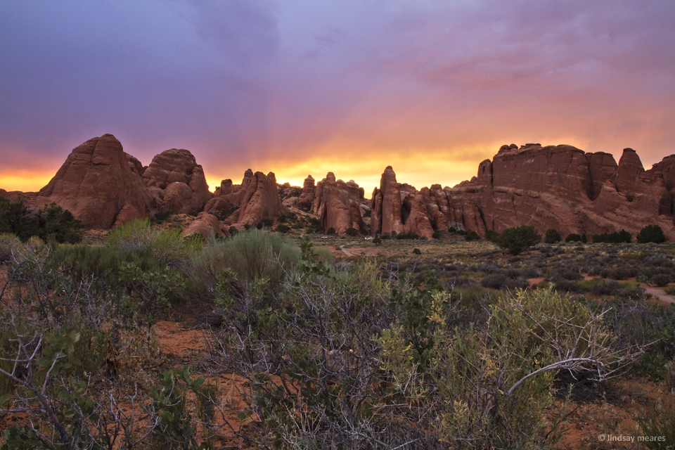
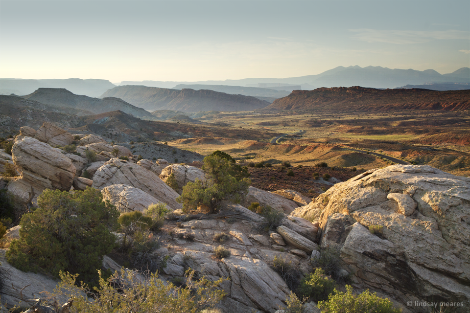
After our steak we started seeking out the best place for sunset. A lot of the arches have short hikes attached to them, and we were thinking of our first night more as a location-scouting evening rather than checking out the arches. We ended up just driving around randomly and checking the roadside vistas.


Sunset looked pretty unexciting until the sun finally dipped below the heavy afternoon storm clouds. At that point, everything lit up with a soft glow and we immediately went into sunset frenzy mode.
At the time the sun appeared we were scouting near the Salt Valley Overlook, but once I had gotten a few shots over there we headed back towards the end of the park road and the Devils Garden trailhead. Travis dropped me off near the parking lot and let me run along the road taking photos for a quarter mile before we met up and jogged up the Devils Garden trailhead looking for sunset photos.

And that was the first day in Arches National Park! Funnily enough, we didn’t actually see any arches on our first day.
We topped off our day by driving to our hotel, arriving late (10pm), and then going to sleep pretty quickly in prep for the 5am wake-up call.
Day 5: Arches National Park
After our 10am-10pm driving day, we were not so well-rested or enthusiastically prepared to go at 5am the next morning.
My preliminary plan was to make it to one of the first few park vistas. Our hotel was 17 miles from the park entrance, and then it takes additional time to get to places within the park. My initial plan had been to visit the La Sal Mountains viewpoint, which is one of the first inside the park; however, I had allotted extra time for possible pre-sunrise color which didn’t appear to be happening (no clouds), so we decided to drive further and make it all the way to the Windows Section of the park.
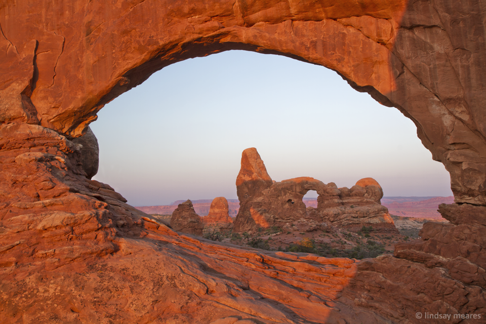
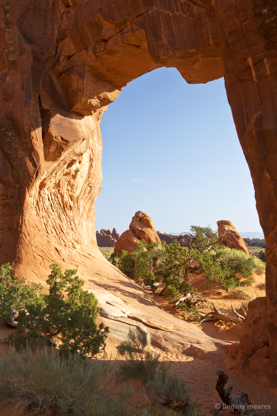
We jogged the primitive side of the Windows Section to reach a viewpoint of the North and South window. My main goal was to get the shot of Turret Arch through the North Window, but I decided to scout and get some other vantage points as well.
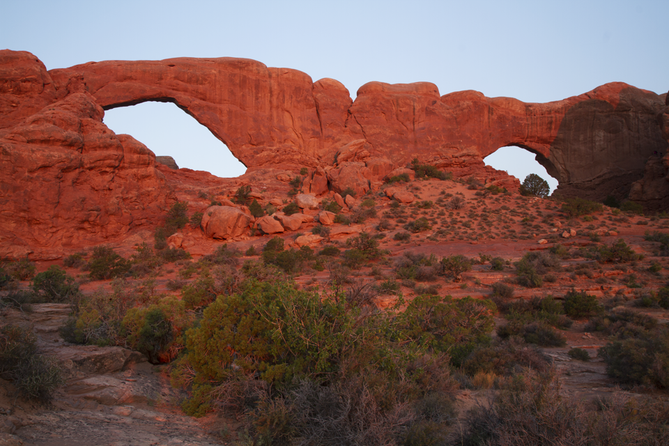
If you take a look into the shadow section on the right of the above image, you can see a tall rock hiding on the side. That’s where you have to scamper up to get the view of Turret Arch through the North Window.

There were some people hanging out in the arch (I cloned them out) and I was a little annoyed that they appeared to belong to the party of some of the photogs up there. They didn’t appear to be posing or anything, just hanging out and ruining everyone elses photos. Oh well.
After I was satisfied with my arch I turned around and took a photo of the view behind me, and then we headed onwards to continue our morning tour of the park.
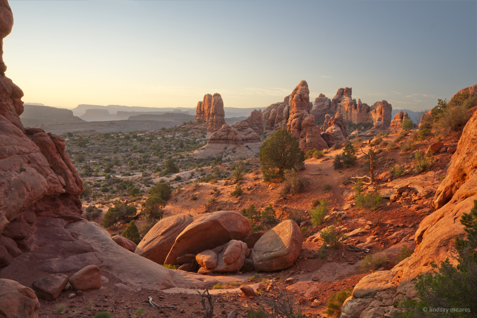
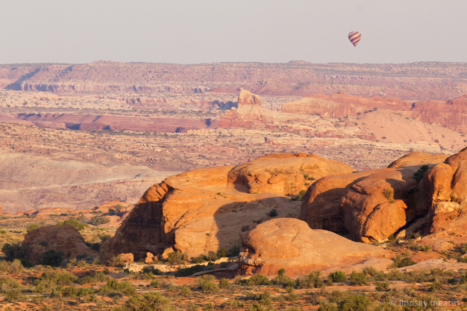
We meandered through the park, stopping at a hot air balloon sighting, Salt Valley Overlook, and then eventually the Devils Garden Trailhead area (where we had caught sunset the previous day), only this time we were going to see the arches.
Off to Devils Garden!
Although we ran down this trail the previous evening, we did not stop to view any of the arches along the way. Now that we had time in the morning we decided to view the first few arches along the trail — Landscape Arch, Pine Arch and Tunnel Arch.
Landscape Arch is the longest of the arches within the park, and is also considered to be the longest natural arch in the world. Some slabs of rock fell off Landscape Arch in 1991, and since then the trail underneath it has been closed off to the public.
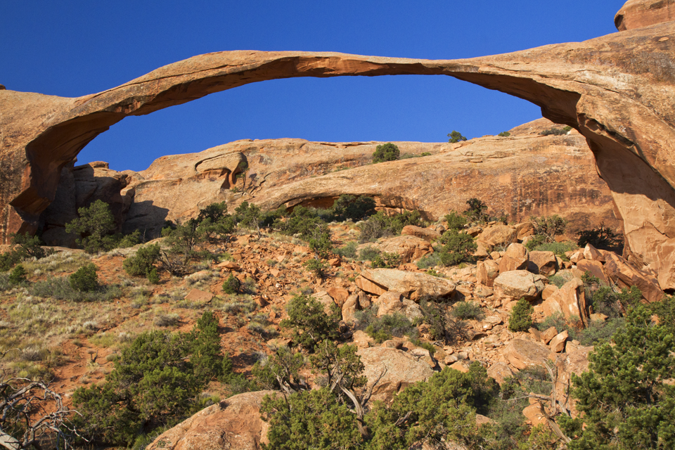
We turned around after Landscape Arch — there are more arches further down the trail, but we’ll have to visit them on a future trip.
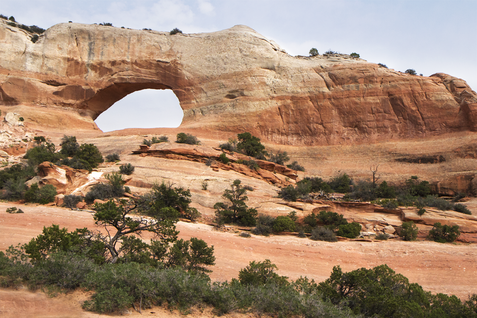
On our route back we found Pine Tree Arch and Tunnel Arch. I really liked Pine Tree Arch.
After that we went back to visit the Park Avenue Viewpoint before heading back to the hotel for a well-deserved nap.
As we were heading back to the hotel I decided I would let Travis decide how we spent the next 24-hours. We were spending 3-nights in Moab, so I would still have plenty of time to do my remaining sites the following day.
He chose to take a nap (a good choice) while I struggled with the frustratingly slow internet and messed around with my photos. After he woke up we checked out the winery attached to the hotel and then watched tv in the room.
After hanging out for awhile, he decided he wanted to go back out, first to explore some areas around Moab (I’ll put those in another post) and then possibly back to the park, but only after we tested the Moab Fiesta Mexicana (sadness & disappointment).
Anyway, back to the park!
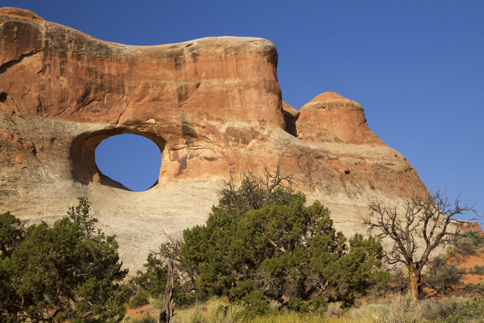
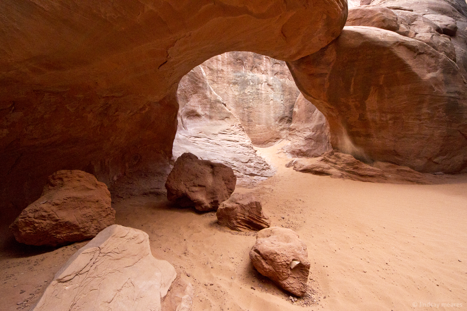
For the evening circuit our first stop was Sand Dune Arch, which is actually hidden between the fins of this rock group:

Then Travis decided he wanted to take our sad little Honda off-roading down the unpaved road into Salt Valley. We drove all the way to the end of the 7.7 mile unpaved road where we reached the trailhead for a couple hikes. Ultimately, we were uncertain about the weather, and we thought that if we were going to take a 3 mile hike for anything it should be to Delicate Arch, the park’s most recognizable arch.
We started the bumpy road back to the main area of the park when we spotted some lightning. Since we had nothing better to do, we thought we’d attempt some lightning photos. I tried putting a 6-stop ND filter on and doing long exposures but the light wasn’t strong enough to register in my camera. In the end I just filled an entire memory card with short exposure attempts hoping to catch something.

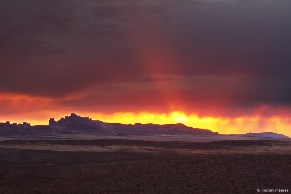
After spending quite some time on the lightning task, it was finally time for (what appeared to be) a pretty fail sunset. There were storm clouds pretty much exclusively in the direction of the sun, and we couldn’t tell if there was a gap for the sun to peek through or not.
I was about ready to call it and tell Travis to drive back to the hotel when I turned around and everything behind me was entirely red.
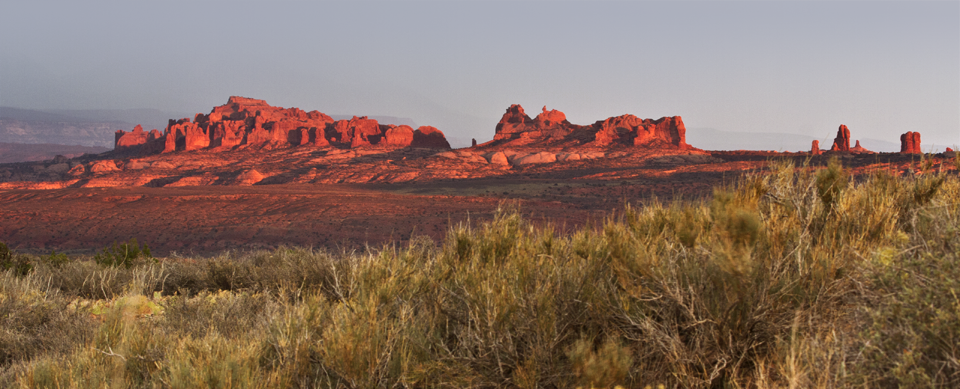
I gasped excitedly (Travis later told me he was expecting more from the landscape after my excitement) and started taking photos of the lovely red landscape.
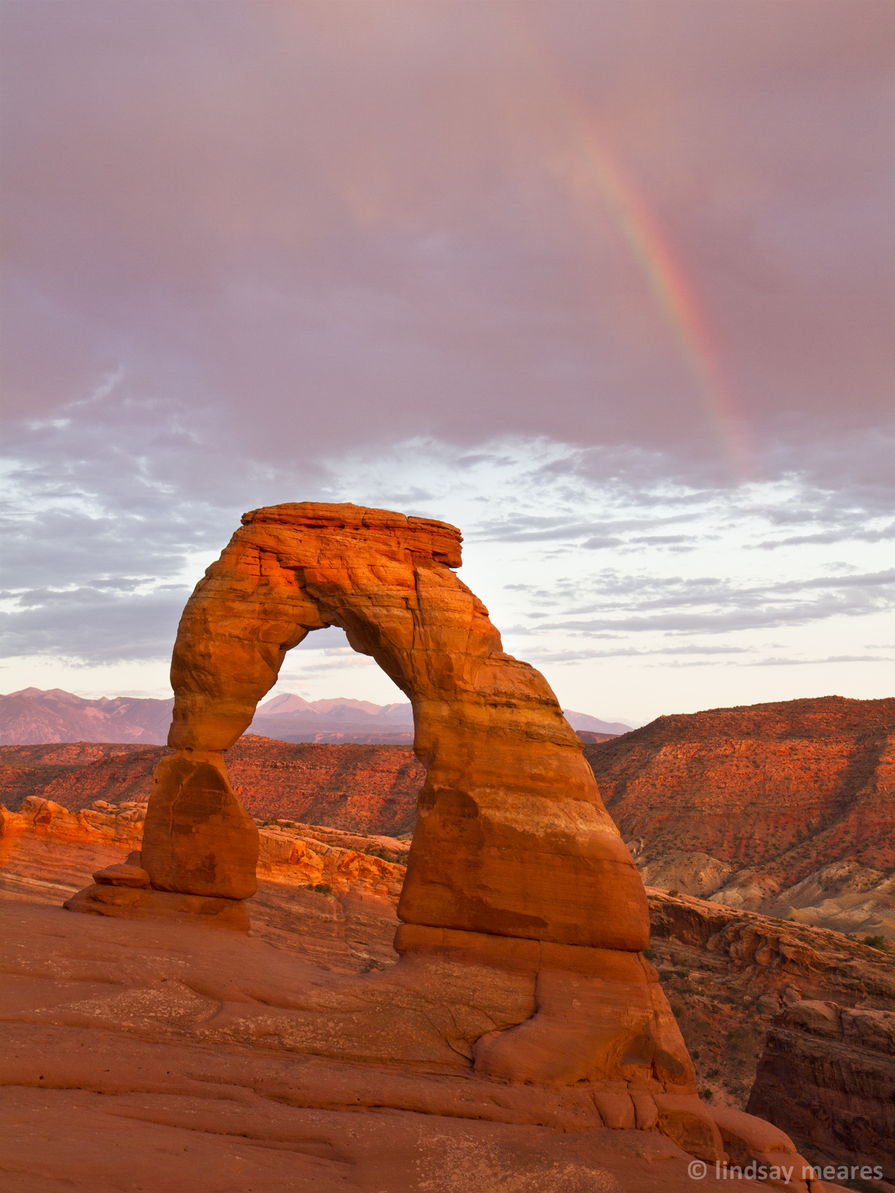
There was even a little rainbow, although not really in a good spot for anything. It was taller on the right side of the rainbow, but there was nothing in the foreground.
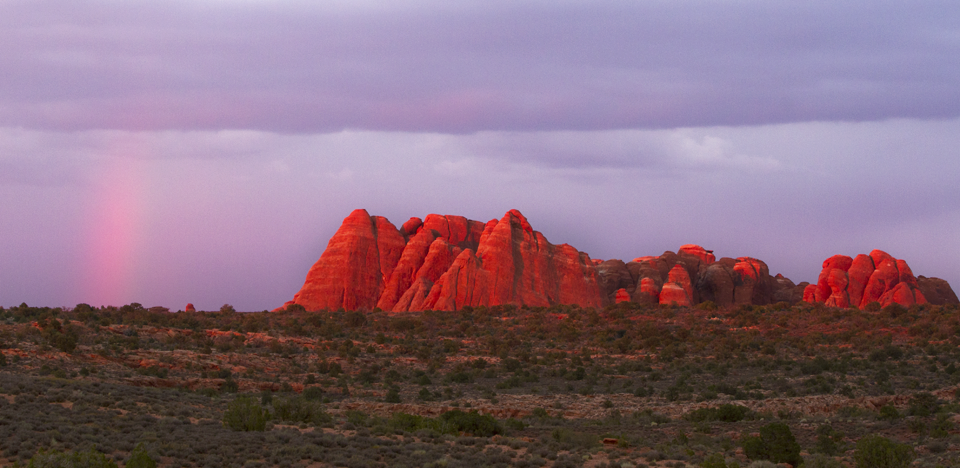
Then a vivid sunset silhouette of the Klondike Bluffs:
And that’s that for day 2 in Arches.
Day 6: Arches National Park
Day 3 we slept in, then packed up our Moab hotel room in preparation for round 2 of camping. Great Sand Dunes had some crazy campfire restrictions but Arches was still in the clear. We picked up some fresh hot dog buns and firewood in preparation.
Sadly enough, we were so excited to reach the main area of Moab (our hotel was 17 miles outside Moab) and find real internet that we may or may not have spent 2 hours in the parking lot of a random motel mooching their wifi. We also selected our lunch location purely based off the fact they had free wifi.
After our wifi session, we headed out to Dead Horse State Park, which I’ll add into another post (I thought I’d do one post for Arches and one post for near-Arches). We thought about visiting Canyonlands National Park, but we knew the few hours we had wouldn’t do it justice so we decided we’d have to work it into a future trip to the area.
Anyway, we arrived in Arches around 5pm to set up camp.
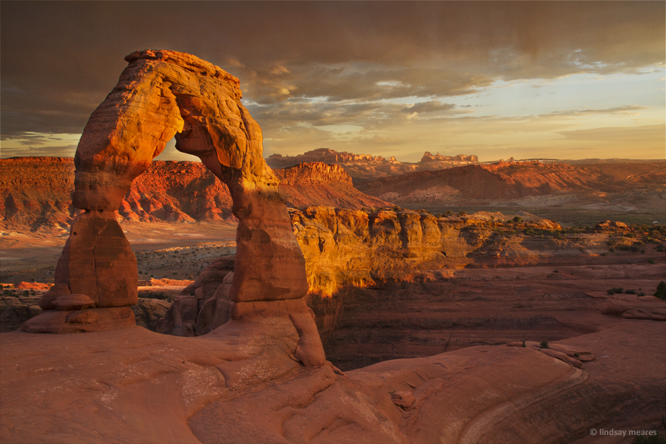
After we fought the tent, Travis cooked us some hot dogs and we sat around until it was time for our pre-sunset hike up to Delicate Arch.
Delicate Arch is the most widely-recognized arch from Arches National Park. It requires a 3 miles hike (round trip) which is mostly uphill going and in the sun.
We waited until the final day of our trip to avoid crowds — we figured it had to be best going the Monday after the long July 4th weekend rather than the Saturday we arrived. The hike itself wasn’t bad — it was uphill certainly, but the sun was hidden behind the afternoon rain clouds so we didn’t have much heat to deal with.
When we arrived at the top the arch was still in shadow. Some people were taking turns taking photos underneath the arch while everyone else was staking out a spot for sunset.
The casual photographs under the arch had thinned out by the time the sun finally dipped below the clouds. Everyone started snapping away on their cameras.
A rogue family thought they might take a picture under the arch while it was lit — they started walking under the arch when someone shouted “get out!” The family seemed confused, but then more people joined in and told them to get away from the arch. They walked a few feet out and thought they might take their photo there, but people continued to shout at them until they had completely cleared the area. I’ve never seen that happen in a national park (or anywhere, really), but I was amused and pretty appreciative that I wouldn’t have to clone any rogue people out of my arch photos.
I tried to think of any other places we’ve been where people wander through landmark photos at sunset, but I couldn’t think of any. I think Delicate Arch is pretty unique in it’s a highly photographed object but also really easy to walk up to and take a photo underneath.
I moved around as much as I could to get different angles at sunset. It turned out the night we selected to walk up to Delicate Arch was the best weather of all our three nights in Arches (sunset-wise). There was even a small rainbow!
After that, we trekked back to our campsite for some evening woodfires and s’mores — real camping! We hadn’t had a wood fire in forever. When we camped in Chaco Culture National Monument we only had charcoal, and obviously we couldn’t have one in Great Sand Dunes. Then our steak and hot dog grilling excursions were also charcoal only.
Anyway, there’s something about wood campfires that makes it seem real.
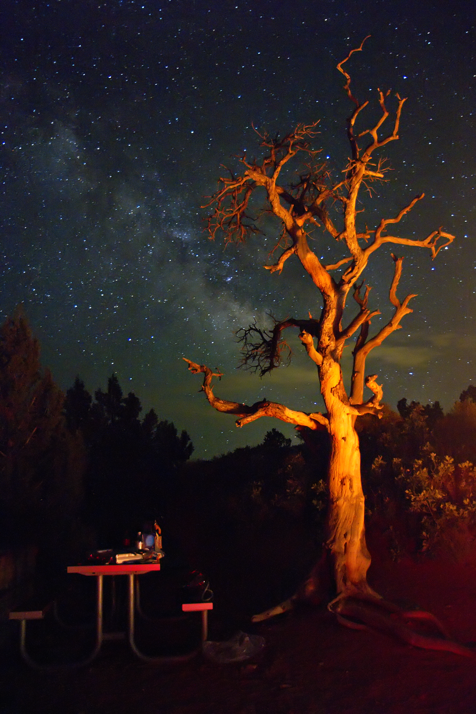
So after we sat around discussing the proper methods of getting the perfect amount of toasty brown on the marshmallow, I decided to do some photo scouting from the campsite (locate milky way). It didn’t take too long — it was right behind the gnarly tree hanging out next to our campfire:
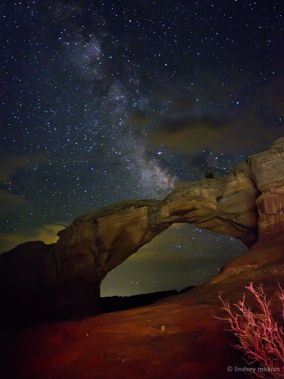
We toasted a few more s’mores while Travis worked out which arc might be best to get some milky way shots. He decided on Broken Arch or Skyway Arch, both near the campgrounds.
We started out on the midnight trek to Broken Arch — 0.8 miles from the trailhead, which was a short distance from our campsite. It was disorienting walking through the trail in the middle of the night with a flashlight — most of it was easy to follow with the footprints of others in the sand, but there was also a section across sandstone where we had to follow the little rock piles to avoid getting lost. Luckily we weren’t worried about bears.
After reaching Broken Arch I set up the camera. It ended up being a bit cloudy in the area, but we hung out for about an hour testing various camera settings, light painting techniques and waiting for the clouds to clear.
And back at the campsite, 1:30am. Would I rise at 5:30am for sunrise? (no)
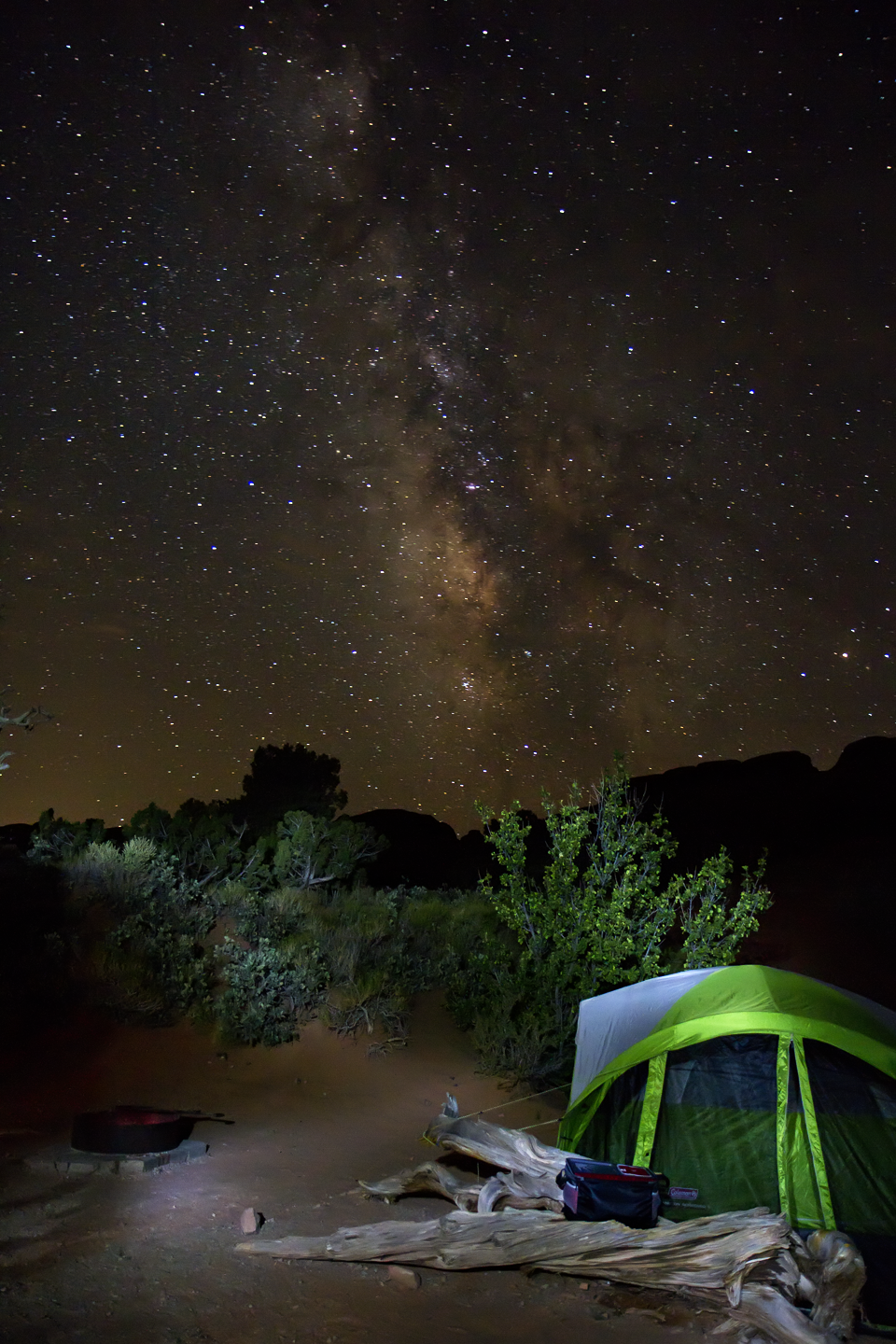
I did, however, take a few more shots of our tent and campsite with some milky way.
Day 7: Arches National Park
I set an alarm for 5:30 am (4 hours of sleep, ugh) but when I checked I didn’t see any fluffy clouds so I went back to sleep.
Around 8am, the heat of the sun finally got us out of bed and we fought with the tent to get it back into the car so we could head onwards to Arizona. We didn’t do any sightseeing/photos of Arches on the way out other than attaching a GoPro to the car window and recording the entire drive. We’ve been recording stuff for fun this trip, although I have no idea what I’m going to do with all this random footage when we’re done. Anyone want to see a video of the main scenic road from Arches? 🙂